Mastergeehy to Waterville
Distance: 9km | Ascent: 270m | Time: 3hrs 45mins

Coomcallee from Coomduff
Start: Mastergeehy Post Office (V 5525 7210)
Finish: Waterville (V 5030 6605)
OS Map: No. 83
Grade: Hard
Leaving the post office at Mastergeehy, the Kerry Way climbs 200m over the first 2km out of the Inny Valley to the summit of Coomduff. The trail initially follows a road past an old abandoned church before trading the tarmac surface for off-road terrain. It then skirts the edge of a forest before following an old green-road up to the mountain ridge and reaching Coomduff.
A few hundred metres before summiting Coomduff, the trail splits into two. The downhill path is the inland section of the Kerry Way from Waterville to Caherdaniel. It is possible to bypass the Waterville section of this by starting at Mastergeehy.
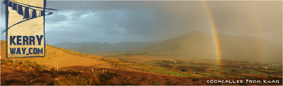
Standing on the summit of Coomduff, the views to the north are of Aghatubride, Foilclogh and Beenduff. The south-east is dominated by Coomcallee. Lough Currane is to the south-west with Mullaghbeg, Cahernageeha and Farraniaragh Mountains forming the backdrop. Waterville can be seen on the western horizon with Ballinskelligs Bay and the Atlantic Ocean beyond it.
The following 5km of ridgeline remains on rough boggy terrain. Progress is slow as the trail goes over Knag and works its way down a spur through lower-lying farmland to reach Termons. From here, the final 2km of the Kerry Way leads into Waterville on a quiet country road. Given the right weather conditions and time of day, the sun may be starting to set over the Atlantic Ocean lighting up the sky in a festival of colour.
Connecting Stages...
Prev : Coars to Mastergeehy
Next : Waterville to Caherdaniel by Coast
Next : Waterville to Caherdaniel Inland

