Coars to Mastergeehy
Distance: 8km | Ascent: 250m | Time: 3hrs 30mins

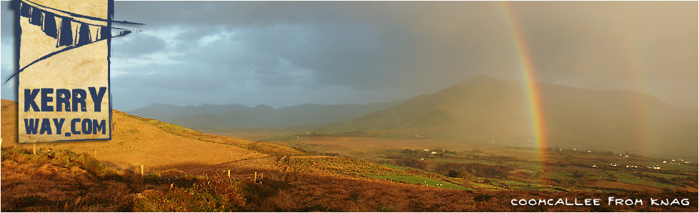
Views from Keelnagore on the Kerry Way
Start: Coars National School (V 5425 7910)
Finish: Mastergeehy Post Office (V 5525 7210)
OS Map: No. 83
Grade: Hard
Although the ridge walk over Knockavahaun offers fantastic views of the surrounding mountains, the boggy conditions underfoot makes progress very slow. Proper hiking boots are essential for this stage of the Kerry Way.
A steep start from Coars National School sees the Kerry Way ascend through a rocky outcrop to meet the ridge at Keelnagore. Standing on the edge of the Inny Valley, views to the north-east include Caunoge to the fore of Teermoyle Mountain, Coomacarrea and Meenteog. The broad peaks and steep cliffs of Coomcallee loom to the south-east. After 2½km of climbing, the trail arrives at summit of Knockavahaun (371m).
The Kerry Way now swings to the south-east, following the remains of an old wall. The trail drops 140m before briefly climbing again to reach the summit of Canuig after 1½km. After skirting the edge of some forestry through some extremely boggy ground, the last 1km of the 190m descent passes through farmland containing livestock and joins a small country road.
The final 3km of this section is a road-walk to Mastergeehy. The road crosses the broad valley floor where cut-away peat bogland can be seen. The Kerry Way then crosses over the River Inny, where canoeists can sometimes be spotted battling against the currents. The last ¾km joins a wider road which provides an occassional passing car and leads up to the post office.
Connecting Stages...
Prev : Cahernaman to Coars
Next : Mastergeehy to Waterville

