Glencar to Glenbeigh
Distance: 12.5km | Ascent: 420m | Time: 5hrs 15mins

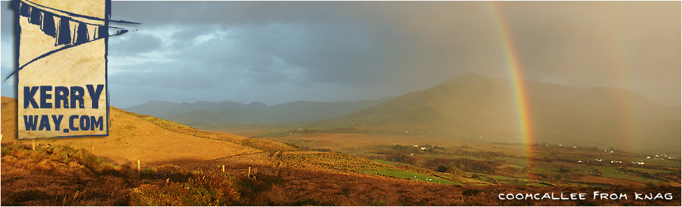
A view of 'The Reeks' from Lickeen Wood
Start: The Climber's Inn (V 7250 8410)
Finish: Glenbeigh Church (V 6700 9110)
OS Map: No. 78
Grade: Moderate
Leaving the Climbers Inn, a boreen heads south-west for 1km. After crossing Bealalaw Bridge, the trail briefly follows the course of the River Caragh for a few hundred metres. The Kerry Way then swings north-west and skirts some forestry before penetrating it. Within ½km the trail joins a gravel forestry track.
Passing through Cosha South, there are beautiful rocky crags with trees clinging on to it at the foot of Toornaneaskagh. Near the end of 2km of forestry road, the trail catches glimpses through the trees of Drombrane Lake. The trail then joins a tarmac road for ½km before arriving at Lickeen Wood.
The next 1km of the Kerry Way passes through beautiful mixed forestry. A short rise of 60m exposes panoramic views across the wooded valley of Glencar to the MacGillycuddy Reeks and then to Lough Caragh and Seefin upon rounding the hill. A series of rocky outcrops and primeval dells lead the trail back to a gravel forestry road and out of Lickeen Wood, close to Blackstones Bridge.
Over the next 3½km the Kerry Way follows a quiet back road and slowly climbs for 150m out from the forestry at Drom East. After turning off at an old school at Bunglasha a boreen passes an area of moorland and a small forest, up to the lower slopes of Seefin.
The deteriorating road eventually reaches a Gortdirragh, where the Kerry Way reaches a T-Junction. The left turn is the direct path to Glenbeigh, whereas the alternative route to the right (described below) takes a more relaxed approach to the town.
Taking the left turn, 1km of rocky track climbs 100m to the saddle at Windy Gap. Views of Lough Caragh and 'The Reeks' are traded for vistas of Rossbeigh Hill, Inch Strand and the Dingle Peninsula. 1km of rough trail descends to meet a boreen at Gowlane, where the final 2km of tarmac road lead to the centre of Glenbeigh.
Alternative to crossing Windy Gap
Taking the right turn at the Gortdirragh T-Junction will follow an alternative 8km of Kerry Way signs to reach Glenbeigh. The first 3½km is on a green road with little ascent before a 50m descent approaching Cosha North. During this time the road skirts the base of Seefin, giving views over Lough Caragh and the distant MacGillyCuddy Reeks.
After joining a quiet road at Treanmanagh, the next 2½km of trail threads through a saddle near Commaun, giving final views of the River Caragh as it makes its journey to the sea. It then descends around 80m to eventually meet the Ring of Kerry Road, which leads the last 2km section into the centre of Glenbeigh.
It is possible for walkers to complete both of these sections of the Kerry way. Starting from Glenbeigh, a circuit of Seefin can be done as a full-day walk in its own right.
Connecting Stages...
Prev : Bridia Valley to Glencar
Next : Glenbeigh to Mountain Stage

